Spatial analysis of air pollution exposure and walkability index in Greater Boston
Problem Statement
This project investigates the exposure of pedestrians to air pollution, specifically nitrogen oxides (NOx), across the Greater Boston Metropolitan Area, and examines how this exposure relates to the walkability of different neighborhoods. With growing urban populations and a push toward sustainable, walkable cities, understanding the environmental quality of pedestrian spaces is essential.
Engineering: Datasets
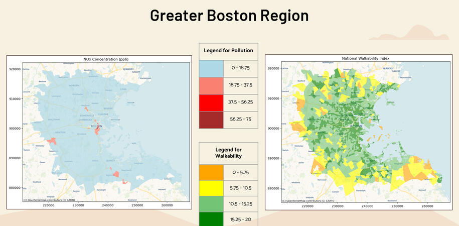
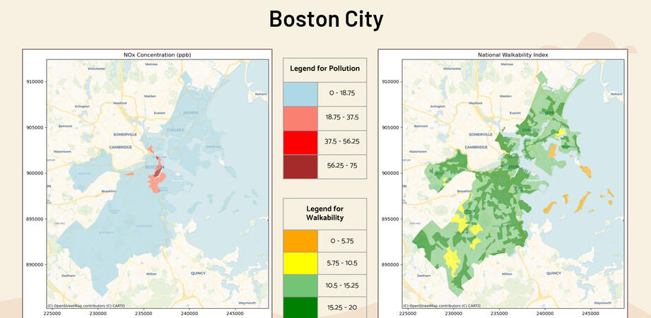
Census 2010 Census Block Groups (CBGs) boundary shapefile provided by MassGIS.
National Walkability Index dataset, part of Smart Location Mapping provided by United States EPA.
NOx Concentration in ppb downloaded for Greater Boston Area (10m x 10m grids) from the C-LINE tool.
All three datasets were cleaned, transformed, and merged using the Census Block Group as the common spatial unit. The resulting dataset was then used for analysis.
Analysis: Visualizations
Analysis: Modeling
We conducted various spatial regression analyses - including baseline, spatially lagged exogenous (SLX), and spatially lagged endogenous (SAR) models - to examine the relationship between walkability, its contributing factors, and NOx concentrations at the Census Block Group level in the Greater Boston Region.
Analysis: Results
The National Walkability Index was found to be statistically significant and positively associated with NOx concentration, indicating that more walkable areas may experience higher levels of air pollution. Spatial regression results also show spatial dependence between walkability and NOx levels.
Among the components of the Walkability Index, Intersection Density and Employment and Household Mix were both found to be statistically significant with positive coefficients, and exhibit spatial dependence with NOx concentration as well.
Application: Policy Recommendations
Expand and promote public transportation in high-walkability areas to reduce reliance on personal vehicles and lower traffic-related NOx emissions.
Increase green infrastructure such as tree-lined streets, small urban parks, and green buffers in neighborhoods with both high walkability and elevated air pollution levels, to improve air quality and provide healthier walking environments.
Encourage clean transportation options, including electric vehicles and bicycles, by expanding charging infrastructure, bike lanes, and incentive programs in dense urban areas.
© Untitled. All right reserved.